


Northeast Maine--Aroostook & Washington Counties PUMA, Maine
About
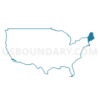
Outline

Summary
| Unique Area Identifier | 193034 |
| Name | Northeast Maine--Aroostook & Washington Counties PUMA |
| State | Maine |
| Area (square miles) | 10,085.22 |
| Land Area (square miles) | 9,233.99 |
| Water Area (square miles) | 851.23 |
| % of Land Area | 91.56 |
| % of Water Area | 8.44 |
| Latitude of the Internal Point | 46.11592130 |
| Longtitude of the Internal Point | -68.26496440 |
Maps

Graphs
Select a template below for downloading or customizing gragh for Northeast Maine--Aroostook & Washington Counties PUMA, Maine


Neighbors
Neighoring Public Use Microdata Area (by Name) Neighboring Public Use Microdata Area on the Map
- Coastal Maine Region--Hancock, Knox, Waldo & Lincoln Counties PUMA, ME
- Northwest Maine--Oxford, Somerset, Franklin & Piscataquis Counties PUMA, ME
- Penobscot County PUMA, ME
Top 10 Neighboring County (by Population) Neighboring County on the Map
- Penobscot County, ME (153,923)
- Aroostook County, ME (71,870)
- Hancock County, ME (54,418)
- Somerset County, ME (52,228)
- Washington County, ME (32,856)
- Piscataquis County, ME (17,535)
Top 10 Neighboring County Subdivision (by Population) Neighboring County Subdivision on the Map
- Presque Isle city, Aroostook County, ME (9,692)
- Caribou city, Aroostook County, ME (8,189)
- Houlton town, Aroostook County, ME (6,123)
- Fort Kent town, Aroostook County, ME (4,097)
- Madawaska town, Aroostook County, ME (4,035)
- Fort Fairfield town, Aroostook County, ME (3,496)
- Calais city, Washington County, ME (3,123)
- Limestone town, Aroostook County, ME (2,314)
- Machias town, Washington County, ME (2,221)
- Van Buren town, Aroostook County, ME (2,171)
Top 10 Neighboring Place (by Population) Neighboring Place on the Map
- Presque Isle city, ME (9,692)
- Caribou city, ME (8,189)
- Houlton CDP, ME (4,856)
- Calais city, ME (3,123)
- Madawaska CDP, ME (2,967)
- Fort Kent CDP, ME (2,488)
- Van Buren CDP, ME (1,937)
- Fort Fairfield CDP, ME (1,825)
- Eastport city, ME (1,331)
- Machias CDP, ME (1,274)
Top 10 Neighboring Unified School District (by Population) Neighboring Unified School District on the Map
- Regional School Unit 24, ME (19,403)
- School Administrative District 01, ME (13,082)
- Regional School Unit 39, ME (10,756)
- School Administrative District 29, ME (8,099)
- School Administrative District 27, ME (6,804)
- School Administrative District 67, ME (6,318)
- School Administrative District 37, ME (5,901)
- Madawaska, ME (4,035)
- School Administrative District 70, ME (3,784)
- School Administrative District 20, ME (3,496)
Top 10 Neighboring State Legislative District Lower Chamber (by Population) Neighboring State Legislative District Lower Chamber on the Map
- State House District 88, ME (9,250)
- State House District 27, ME (8,919)
- State House District 33, ME (8,910)
- State House District 30, ME (8,609)
- State House District 5, ME (8,554)
- State House District 9, ME (8,533)
- State House District 7, ME (8,358)
- State House District 34, ME (8,229)
- State House District 4, ME (8,189)
- State House District 6, ME (8,161)
Top 10 Neighboring State Legislative District Upper Chamber (by Population) Neighboring State Legislative District Upper Chamber on the Map
- State Senate District 28, ME (38,444)
- State Senate District 30, ME (38,142)
- State Senate District 26, ME (37,802)
- State Senate District 34, ME (36,751)
- State Senate District 29, ME (35,857)
- State Senate District 27, ME (35,681)
- State Senate District 35, ME (35,119)
- State Senate Districts not defined, ME (0)
Top 10 Neighboring 111th Congressional District (by Population) Neighboring 111th Congressional District on the Map
Top 10 Neighboring Census Tract (by Population) Neighboring Census Tract on the Map
- Census Tract 9517, Aroostook County, ME (4,783)
- Census Tract 9506, Aroostook County, ME (4,097)
- Census Tract 9503, Aroostook County, ME (4,035)
- Census Tract 9524, Aroostook County, ME (3,825)
- Census Tract 9565, Washington County, ME (3,716)
- Census Tract 9518, Aroostook County, ME (3,693)
- Census Tract 9510, Aroostook County, ME (3,569)
- Census Tract 9513, Aroostook County, ME (3,386)
- Census Tract 9564, Washington County, ME (3,316)
- Census Tract 9526, Aroostook County, ME (3,195)
Top 10 Neighboring 5-Digit ZIP Code Tabulation Area (by Population) Neighboring 5-Digit ZIP Code Tabulation Area on the Map
- 04730, ME (9,992)
- 04736, ME (9,876)
- 04769, ME (9,692)
- 04743, ME (4,676)
- 04742, ME (3,496)
- 04654, ME (3,424)
- 04756, ME (3,344)
- 04619, ME (3,121)
- 04757, ME (2,870)
- 04750, ME (2,603)